Cart
Sub-Total: $0.00
10 min read

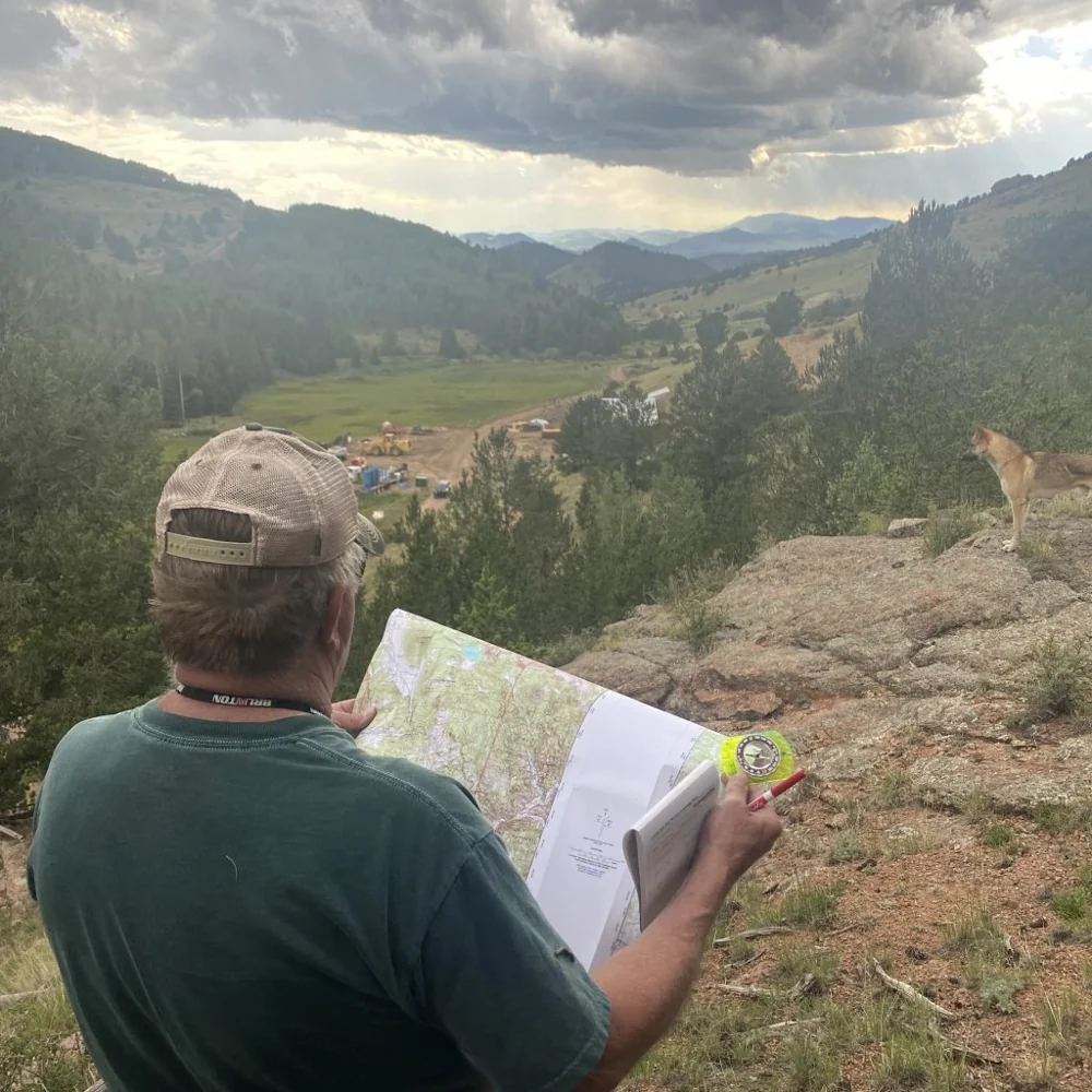
Your phone says you’re three miles from the trailhead. You’ve got a little blue dot showing your location, a nice colored line telling you where to go, and a reassuring little arrow pointing in the direction you’re supposed to be traveling. Life is good. Technology is wonderful. What could possibly go wrong?
Well, let’s see. Your battery could die, your phone could take a swim in a creek, you could drop it off a cliff, or you could discover that the map you thought you downloaded isn’t actually available offline. Maybe the GPS signal is unreliable because you’re in a steep canyon, or perhaps you simply make the mistake of following that little blue dot without paying attention to what’s happening around you.
And now you’re standing in the woods, staring at a very expensive piece of technology that’s about as useful as a rock. At least with the rock, you could use it to pound something.
I’m not against GPS. I use modern navigation equipment, and I think it’s fantastic when used correctly. But there’s a tremendous difference between using technology to support your navigation skills and depending on technology because you don’t have any.
If you spend time hiking, hunting, backpacking, exploring remote areas, or simply wandering around in the mountains, learning traditional land navigation is one of the most valuable skills you can develop.
There’s a misconception that navigation is simply knowing your current location. While that’s certainly helpful, it’s only part of the process. Good navigation involves understanding the terrain around you, selecting a reasonable route, recognizing your progress, and knowing when something isn’t going according to plan.
Imagine you’re looking at a GPS screen that shows your destination is one mile directly east. Seems simple enough. Just head east, right? Except there’s a steep canyon between you and your destination, a cliff band you can’t safely descend, and a drainage that would make a far better route if you bothered to study the terrain.
That little arrow doesn’t necessarily tell you which route is practical or safe. Some navigation apps provide excellent terrain information and route-planning tools, but you still need to understand what you’re looking at.
A good navigator doesn’t blindly follow a line on a screen. They look at the country around them, compare it with the map, and make decisions based on what the terrain is actually telling them.
That’s where traditional land navigation becomes so valuable.
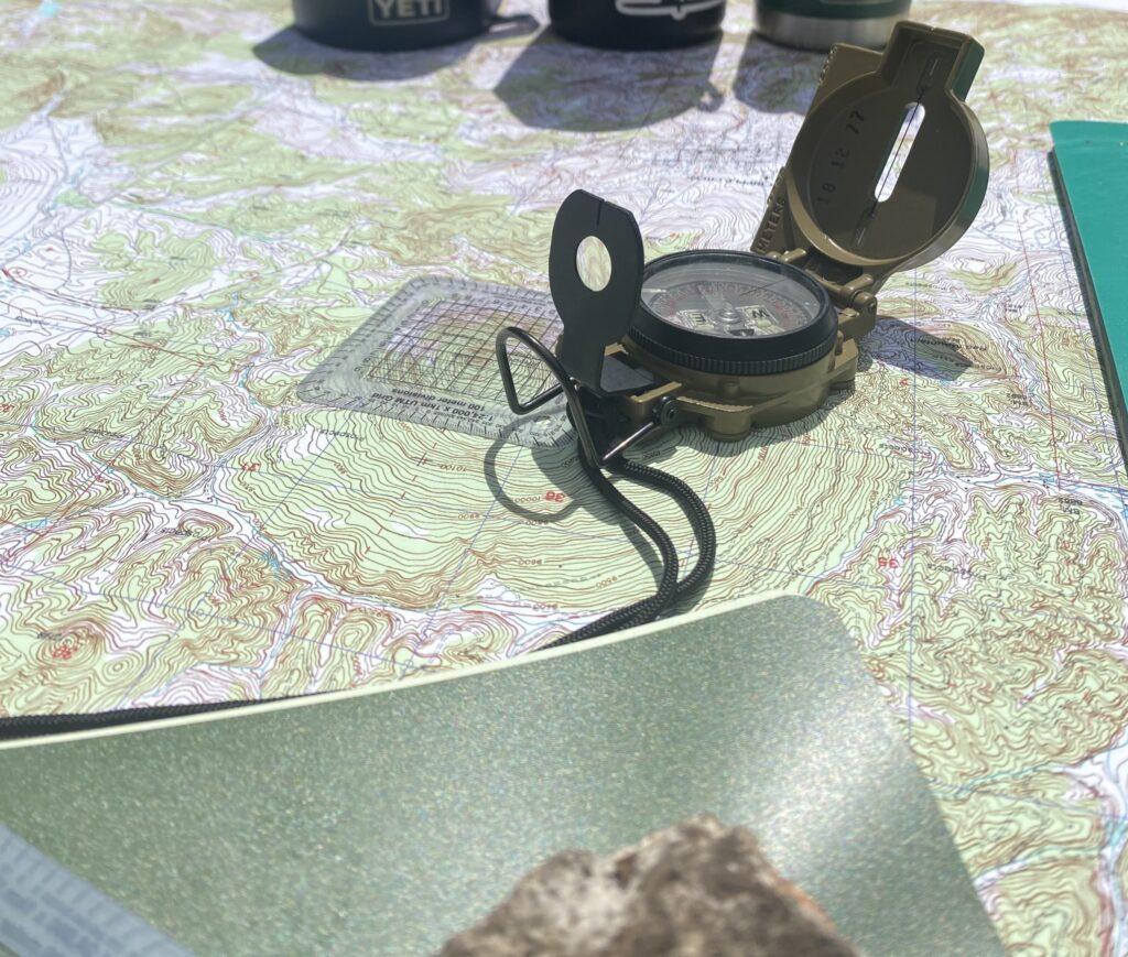
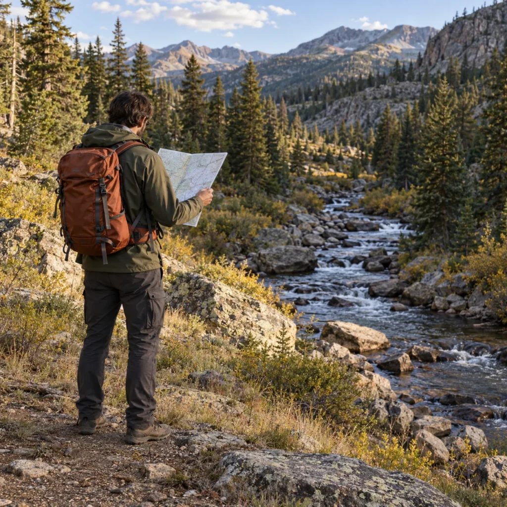
One of the first things we teach in land navigation is how to read a topographic map. At first glance, it might look like somebody spilled a bowl of spaghetti across a piece of paper. There are lines everywhere, strange symbols, numbers, and enough information to make a beginner wonder what they’ve gotten themselves into.
But those contour lines tell a story. They reveal mountains, valleys, ridges, saddles, drainages, steep slopes, and relatively flat areas. Once you understand how to interpret them, you can start recognizing terrain features before you ever set foot on them.
Closely spaced contour lines indicate steep terrain, while wider spacing generally indicates gentler slopes. A saddle might offer an easier crossing between two high points, while a drainage could provide a recognizable feature to follow or a serious obstacle, depending on the terrain.
Now here’s where things get interesting. You can look at the map, identify a ridge, turn around, look at the actual mountain, and recognize that same ridge in front of you. Suddenly, you’re not just following directions. You’re understanding where you are in relation to the surrounding landscape.
We call this terrain association, and it’s one of the foundations of good navigation.
The more you practice it, the less you need to constantly stare at a screen to figure out where you’re standing.

A compass is a wonderful tool. It’s lightweight, relatively inexpensive, and doesn’t require charging every night. But owning one doesn’t mean you know how to navigate with it.
I’ve seen people pull out a compass, watch the needle settle, and immediately announce that they know which direction to go. Wonderful! You’ve identified magnetic north. Now what?
Knowing where north is doesn’t magically tell you where your vehicle is parked, which ridge you need to cross, or how to find a particular location on a topographic map.
You need to understand bearings, azimuths, map orientation, and how to move accurately toward a destination. You also need to understand the difference between true north and magnetic north, including magnetic declination. Depending on where you are, failing to account for declination can send you significantly off course over distance.
And here’s something that surprises beginners. Even if you have the correct bearing, walking a straight line through thick timber, uneven terrain, and obstacles is harder than it sounds. You’ll encounter trees, rocks, gullies, and plenty of other things that force you to adjust your route.
That’s why a compass is only part of the equation. The real skill comes from combining it with a map, your observations, and sound decision-making.
Getting lost doesn’t always start with some spectacular mistake. Sometimes it’s a series of small decisions that seem perfectly reasonable at the time.
You leave the trail to investigate something interesting, assuming you’ll easily find your way back. You take a shortcut around an obstacle and come out a little farther from your intended route than expected. You cross a drainage without paying attention to which direction it’s running, or you confuse one ridge with another because they look similar.
None of those mistakes necessarily means you’re lost. But if you keep traveling without recognizing that your position is becoming uncertain, you’re creating a problem that gets harder to correct with every step.
This is why I teach students to maintain awareness of their surroundings as they travel. Notice major terrain features, trail junctions, drainages, changes in elevation, and recognizable landmarks. Look behind you occasionally, because the route back can look surprisingly different from the route you just traveled.
If you’re following a trail through the woods, stop periodically and ask yourself a simple question: Could I explain where I am right now without looking at my phone?
If the answer is no, you might want to spend a little more time paying attention to the country you’re traveling through.
And if you genuinely lose track of your location, don’t just keep wandering around hoping something familiar will eventually appear. Stop, assess your situation, review your last known position, and work through the problem before making it worse.
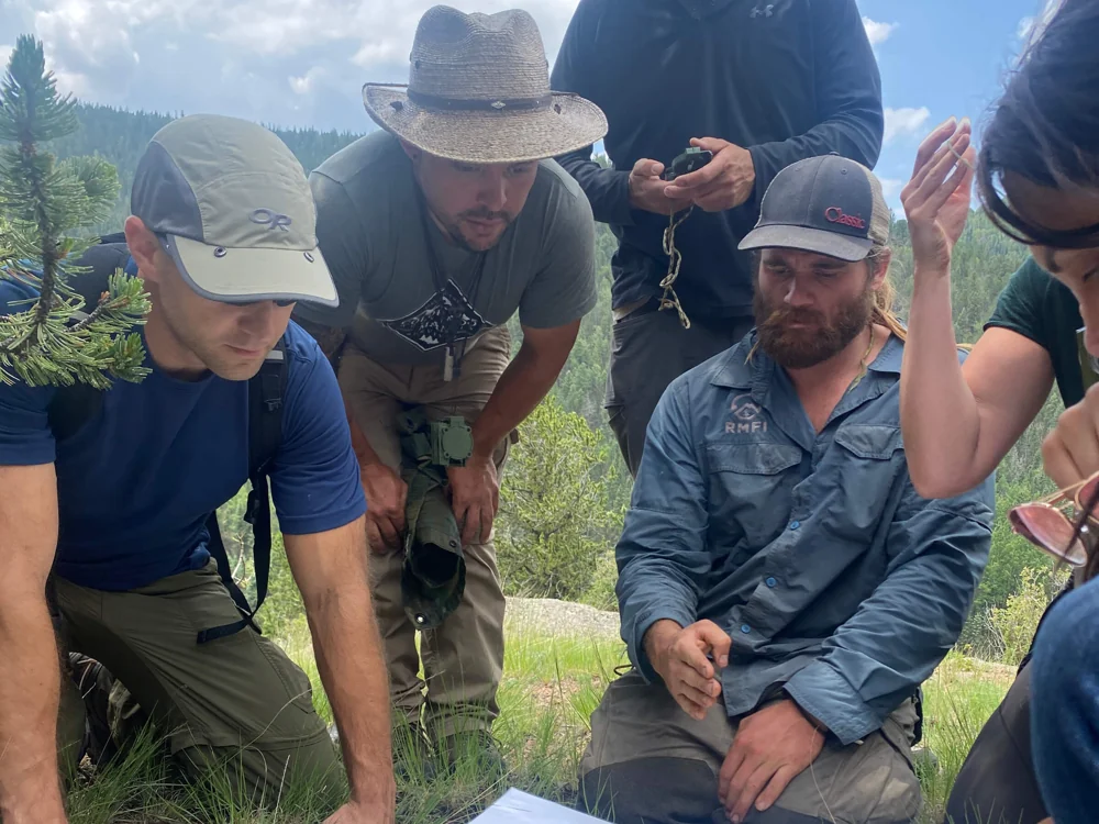
When you’re navigating through the backcountry, there are several techniques that make traveling more accurate and considerably less frustrating.
For example, you can use a recognizable trail, ridge, stream, or other linear feature as a handrail to help guide your movement. You can establish catching features, such as a road or distinctive drainage beyond your destination, that help you recognize when you’ve traveled too far. You can also select an obvious attack point near a difficult-to-find destination, allowing you to make your final approach from a known location.
Then there’s distance estimation. In open terrain, you might judge distance using visible landmarks and map measurements. In thick timber, keeping track of your pace count can help you estimate how far you’ve traveled, although changes in slope, vegetation, fatigue, and stride length can affect accuracy.
None of this is particularly magical, although watching someone confidently navigate through unfamiliar terrain can certainly make it look that way.
The advantage comes from understanding several techniques and knowing when to use them together. If one method becomes unreliable, you have others to help confirm your position.
And that’s something I want students to understand. Navigation isn’t about memorizing one trick and hoping it works everywhere. It’s about developing enough skill to adapt to different terrain and circumstances.
I occasionally hear people argue that there’s no reason to learn traditional land navigation anymore because we have smartphones, satellite navigation, and increasingly sophisticated mapping applications.
I disagree.
We have calculators too, but it’s still useful to understand basic mathematics. We have weather apps, but it’s still worth learning to recognize a developing storm. And we have GPS devices, but that doesn’t eliminate the value of knowing how to read a map and understand the terrain.
Modern technology can make navigation safer and more efficient. Offline mapping, GPS coordinates, satellite communication, and digital route planning are valuable tools when used properly. I encourage students to understand those capabilities and their limitations.
What I don’t encourage is handing over every navigational decision to a device without understanding what it’s telling you.
Personally, I’d rather have someone who knows how to navigate carrying a GPS than someone carrying three GPS devices who couldn’t find their way across a parking lot without a blue dot.
Learn the traditional skills, learn the modern tools, and understand how the two complement each other.
We can spend hours discussing contour lines, bearings, route planning, and magnetic declination. I can draw diagrams on a whiteboard, demonstrate compass techniques, and explain exactly how to navigate from one location to another.
But eventually, you need to put the map in your hands and start walking.
That’s where students discover whether they really understand what we’ve been discussing. It’s one thing to plot a bearing in a comfortable classroom. It’s another to follow that bearing through uneven terrain, recognize the correct landforms, and arrive at a destination you can’t see from your starting point.
You might discover that your pace count changes considerably when climbing a hill. Maybe you mistook one drainage for another, or you realize you didn’t pay enough attention to a terrain feature you passed twenty minutes ago.
Those are valuable lessons, especially when you’re training in a controlled environment where an instructor can help you figure out what went wrong.
I would much rather have a student make those mistakes during training than discover those weaknesses when they’re alone in the backcountry with daylight disappearing.
Real confidence doesn’t come from somebody telling you that you understand navigation. It comes from successfully navigating unfamiliar terrain and knowing you can repeat the process.
Here’s something I’d encourage you to try on your next outdoor adventure. Before pulling out your GPS, take a few minutes to look at a map of the area. Identify the major terrain features, locate your starting point, and think about what you’ll encounter along your intended route.
As you travel, pay attention to your surroundings and try to match the terrain you’re seeing with what appears on the map. Notice the direction of drainages, the shape of ridges, and recognizable features you could use to establish your position.
Keep your GPS available as a backup and for confirmation. This isn’t an invitation to intentionally get yourself lost or wander into unfamiliar terrain unprepared.
The idea is to stop treating navigation as something your phone does for you and start developing the ability to do it yourself.
If you’d like to take those skills further, The Survival University offers hands-on Land Navigation: Map & Compass Skills for the Backcountry training in the Colorado mountains. We also offer Advanced Land Navigation for students who want to challenge themselves with more demanding terrain and navigation exercises.
You can also find upcoming training dates on our course calendar.
Because at the end of the day, that expensive little computer in your pocket is a fantastic tool. But when the screen goes dark, I’d really like you to have something more useful between your ears than the memory of where the blue dot used to be.
Following a river can feel like a way out when you are lost, but downstream does not guarantee a safe route or nearby help. Learn...
Could you find your way back if your GPS stopped working? Learn why map reading, compass skills, and terrain awareness are essential for backcountry navigation.